Get daily updates on temperatures, winds and UVB levels, and see what the SA Weather Service predicts for the country.
Here’s the weather outlook for South Africa’s nine provinces.
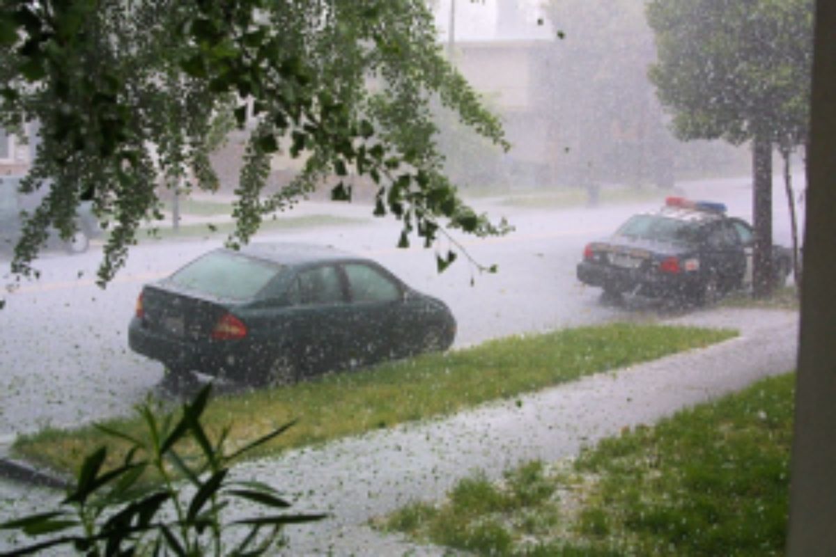
The South African Weather Service has warned that severe thunderstorms with heavy downpours, which may lead to flooding, are expected in seven provinces.
SEVERE WEATHER ALERTS
IMPACT-BASED WARNINGS
A. Yellow Level 4 Warning: Severe Thunderstorms with heavy downpours leading to localised flooding of low-lying areas, susceptible roads and bridges as well as localised damage to infrastructure, settlements (informal), property, vehicles, livelihood and livestock in the Lowveld of Mpumalanga, extreme south-eastern Lowveld of Limpopo and the north-eastern parts of KwaZulu-Natal.
B. Yellow Level 2 Warning: Severe Thunderstorms with heavy downpours leading to localised flooding of low-lying areas, susceptible roads and bridges as well as localised damage to infrastructure, settlements (informal), property, vehicles, livelihood and livestock in Free State, North West, eastern parts of Northern Cape, the extreme western parts of KwaZulu-Natal, Gauteng (excluding the extreme north) and the Highveld of Mpumalanga
FIRE DANGER WARNINGS
NIL
ADVISORIES
NIL
Weather conditions and UVB forecast in South Africa’s provinces
Gauteng
Gauteng can expect partly cloudy and warm with isolated showers and thundershowers.
The expected UVB Sunburn Index is High.
Mpumalanga
Mpumalanga, the Place of the Rising Sun, can expect partly cloudy and warm with isolated showers and thundershowers, but scattered along the Escarpment. It will be cloudy with widespread showers and thundershowers in the Lowveld.
Limpopo
In Limpopo, partly cloudy and warm to hot with isolated showers and thundershowers, but scattered in the east. It will be cloudy with widespread showers and thundershowers in the extreme south-eastern parts.
North West
North West, known as Bokone Bophirima in Setswana, can expect cloudy with morning fog patches over the south-eastern parts, otherwise partly cloudy and warm to hot, with isolated showers and thundershowers.
Free State
In Free State, cloudy with morning fog over most parts, becoming partly cloudy and warm with scattered showers and thundershowers, but isolated in the north.
Northern Cape
The day will start fine and cool in the west, otherwise partly cloudy and warm to hot, with scattered showers and thundershowers. The wind along the coast will be moderate to fresh southerly to south-easterly.
Western Cape
Partly cloudy along the south coast and eastern parts at first, otherwise fine and cool to warm. The wind along the coast will be moderate to fresh southerly to south-easterly but south-westerly along the south coast.
The expected UVB sunburn index is High
Eastern Cape
The Western half: Partly cloudy in the east, becoming cloudy in the north-east with isolated showers and thundershowers. The wind along the coast will be light to moderate westerly, becoming south-westerly mid-morning.
The Eastern half: The day will start with morning fog patches over the interior, otherwise cloudy and cool to warm with isolated showers and thundershowers. The wind along the coast will be light to moderate south-westerly, becoming light and variable in the afternoon.
KwaZulu-Natal
Morning fog over the interior, otherwise cloudy and warm with scattered showers and thundershowers, but isolated in the south-east. Widespread showers and thundershowers is expected in the extreme north-east. The wind along the coast will be moderate to fresh north-easterly north of Cape St.Lucia in the morning, otherwise moderate to fresh south to south-westerly. It will become moderate easterly to south-easterly south of Durban from the afternoon.
The expected UVB Sunburn Index is High
Forecast data provided by the South African Weather Service.
#Violent #storms #heavy #rain #target #provinces