From northern baobab groves and mangroves to southern tropical forests, Senegal’s diverse ecosystems are under mounting pressure. Forests are shrinking due to fires, illegal logging and other human activities, and national authorities estimate the country loses 40,000 hectares of forest each year. As forest cover declines, so does the nation’s carbon sink capacity, releasing more CO₂ into the atmosphere and accelerating global warming. Since measurements began in 2007, the amount of carbon stored in Senegal’s forests has steadily fallen.
The Direction des Eaux et Forêts (DEFCCS) leads efforts to protect these landscapes. In the Kolda region, Lieutenant Mamadou Diop and his colleagues work with communities such as Yassin Madina to reforest burned land, raise awareness and manage forests for firewood or agroforestry. To help identify high-risk areas, including zones vulnerable to wildfires, Diop uses remote sensing tools accessible on his computer and smartphone.
Why accurate carbon maps matter
Forest management relies heavily on national carbon sink maps, which remain outdated and labour-intensive to produce. Rangers gather key data — including tree height, trunk diameter and species — by travelling deep into forests, often by motorbike. This manual work is essential for estimating biomass but is time-consuming and costly.
AI-based High Carbon Stock Approach
To streamline this process, the Carbon Lense Senegal project — implemented by GIZ with support from the BMZ-funded Initiatives Data Economy and FAIR Forward, and in partnership with data354 and the Ministry of Environment and Ecological Transition — is scaling the AI-based High Carbon Stock Approach first piloted in Indonesia, India and Ivory Coast.
The method combines open satellite imagery with locally collected forest inventory data to generate automated carbon maps. By training AI models on biomass data from West African tree species, the system can estimate how much carbon Senegal’s forests store. However, scientific data on many local species is limited. To fill this gap, the project is working with the University of Ziguinchor to build a stronger scientific base for accurate carbon measurement and climate policy.
“An automated carbon map would greatly simplify our forest management work,” Diop said. “Currently, we still travel up to 300 kilometres per week to collect data.”
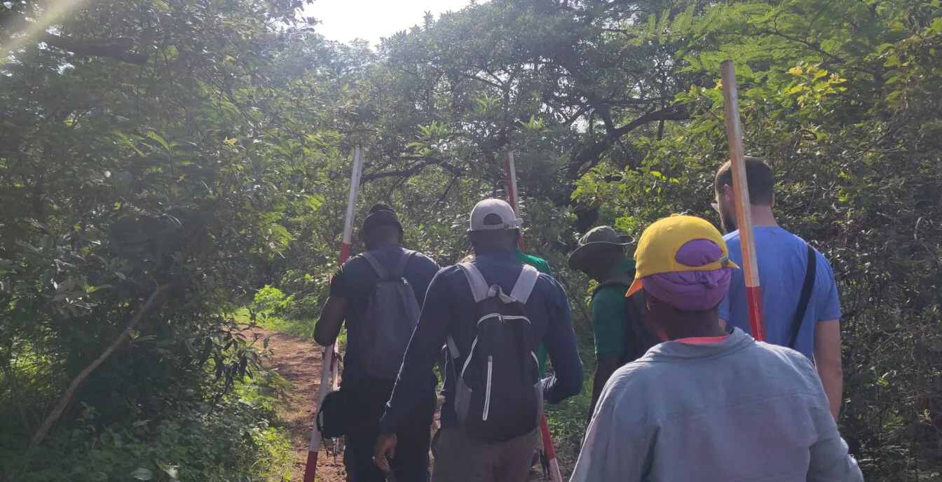
Field testing in Middle Casamance
A first joint field mission tested the DEFCCS inventory protocol in the Boudié forest near Yassine Mandina in the Sédhiou region. The team, which included rangers, University of Ziguinchor experts and GIZ staff, measured sample plots, identified species and recorded biomass data. The forests of Middle Casamance provided an ideal setting for the protocol’s calibration, where rangers regularly encounter illegal deforestation and burn marks.
Community leaders underscored the urgency. “The forests are changing, but we need them for agroforestry. Forest fires pose an additional challenge,” said Babacar Mané, community chief of Yassin Madina.
The project will expand to other ecological zones across Senegal, with the ultimate goal of creating a national biomass map.
Combining local knowledge and digital innovation
Local communities will remain central to the effort. Rangers will contribute ecological expertise and support data collection, ensuring AI-generated outputs reflect on-the-ground realities. Project partners say the initiative demonstrates how digital tools, including AI, can support both biodiversity conservation and climate goals when paired with local knowledge.
The High Carbon Stock Approach will also feed into Senegal’s reporting of its nationally determined contributions under the Paris Agreement. Presented recently at the UNFCCC Technology Executive Committee’s AI for Climate Action Forum 2025 in Tanzania, the project highlights how collaboration between the digital, forestry and climate sectors can drive sustainable transformation.
#Senegal #Turns #AIPowered #Carbon #Mapping #Protect #Shrinking #Forests #Guide #Climate #Action